
Traffic & transport
Strategise and deliver safer, more efficient transport systems.
How Planwisely can help your project
Trips
See where people are travelling to and from.
Combined Spatial Datasets
View multiple complex datasets to support your projects.
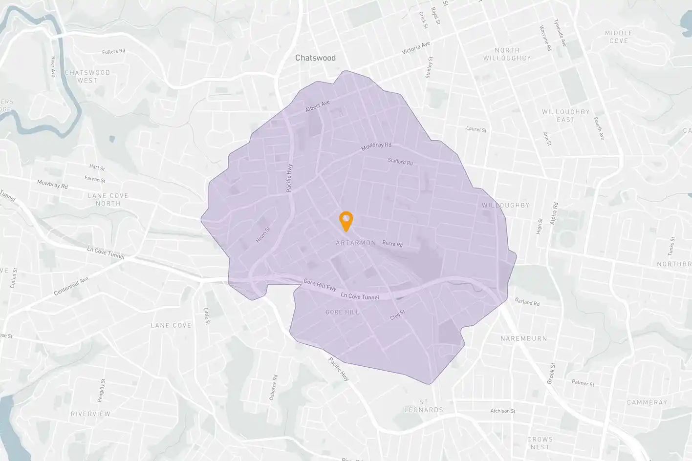
Catchment Analysis Tool
Understand accessibility and extract demographic reports.
Length of Stay
Discover how long people are staying in a location.
Deliver better outcomes today
Planwisely’s rich geospatial library and combination of clever tools and functions make it the perfect platform for:
Transport strategies and plans
Business cases
Cost/benefit analysis
Local Area Traffic Management (LATM) plans
Network planning (Movement and Place)
20-minute neighbourhoods, 30-minute cities and 45-minute regions
Uncover specific travel trends
Optimise your transport project by properly understanding people's travel patterns to and from an area.
Track visitation back to where journeys began - from an SA2 to an LGA level - to identify trends and understand how far people are travelling to reach a location. Plus, you can go even deeper by filtering by weekday, weekend or even by time of day.

Visually combine complex datasets
Create a deep body of evidence for transport strategies, business cases, LATM plans, network plans (Movement and Place framework) and more by combining spatial datasets within the one map view.
Bring together demographic and mobility data, traffic counts and more in one place to deliver telling insights that inform your decision making process.


Understand location potential and accessibility
Assess the multi-modal accessibility of specific locations with a catchment analysis.
Specify your catchment to and from destinations like train stations, bus stops and more, then define your catchment by mode and time. Then, generate demographic reports to uncover deeper insights into the people within your catchment.
Discover where people spend their time
Understand how long people stay in a specific area, if that has changed over time and when they're visiting - as well as identify the busiest and quietest times of day.
View length of stay and visitation peaks and troughs across the entire day, and filter that data by time of day, weekday or weekend to understand when your public space is performing at its best.
Clients using this feature

Want to get started with Planwisely?
Use powerful geospatial datasets to uncover insights, guide your decision-making process and deliver better outcomes for your project today.